Tintagel to Boscastle: The Coast Walk Along Cornwall's Arthurian Coast

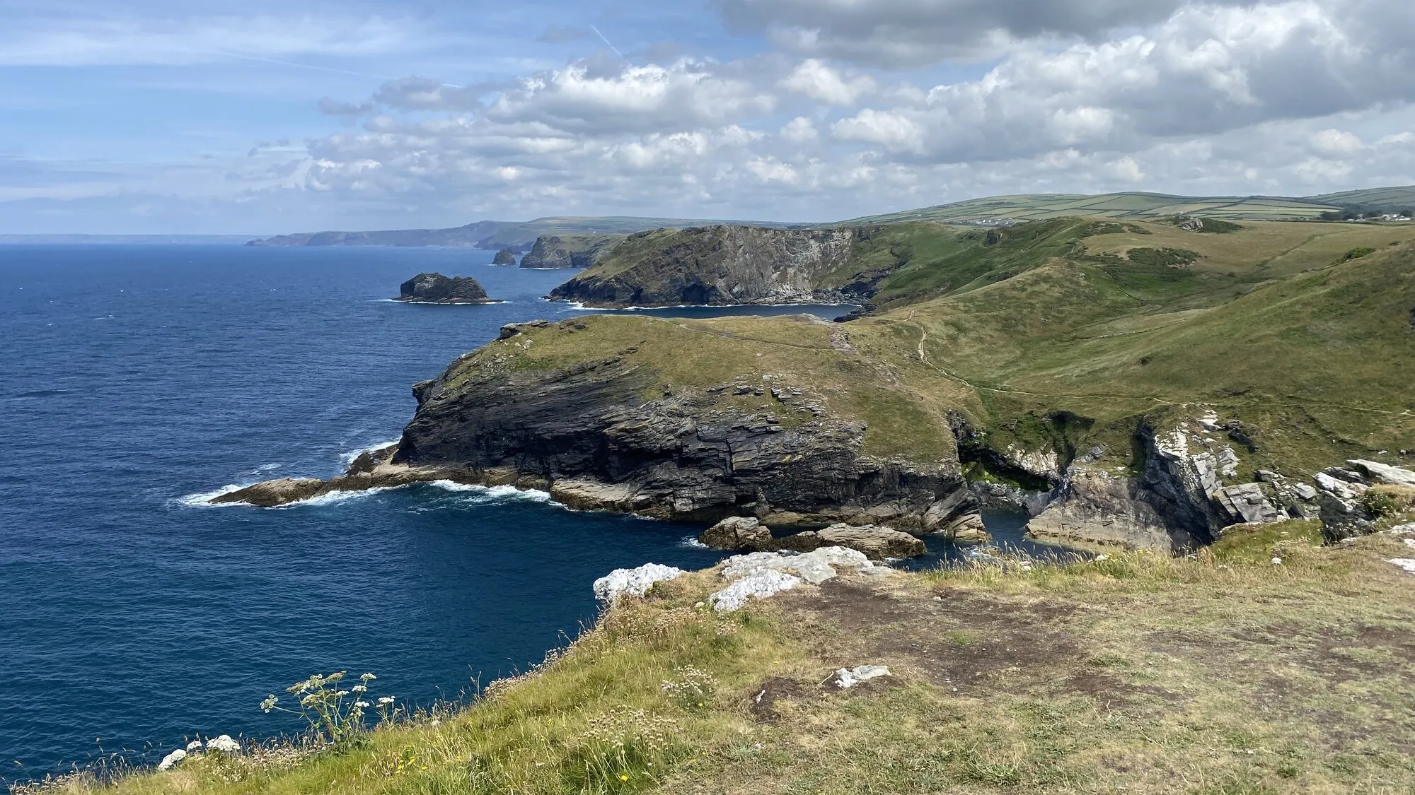
The stretch of the South West Coast Path from Tintagel to Boscastle packs an enormous amount of North Cornwall into four and a half miles. You start beneath the ruins of Tintagel Castle, the island fortress bound up with the legend of King Arthur, and finish at the sheltered stone harbour of Boscastle. In between is some of the most dramatic clifftop walking on the whole of the Cornish coast: high dark slate cliffs, a river gorge at Rocky Valley, ancient carvings, and the long Atlantic horizon the whole way.
It is short in distance but not in effort. This is the practical guide: the route, how far and how hard, where to park, how to get back, and how the walk fits a couples' break in Cornwall from a Trewena base down on the south coast.
The walk in brief
- Distance: around 4.5 miles (7 km) one way
- Time: 2.5 to 3.5 hours at a walking pace, plus stops
- Difficulty: strenuous; short but with a lot of climbing in and out of valleys
- Start: Tintagel Castle / village
- Finish: Boscastle harbour
- Path: South West Coast Path, well waymarked with the acorn symbol
- Map: OS Explorer 111 (Bude, Boscastle and Tintagel)
The mileage undersells the day. The coast between the two villages is cut by several steep valleys, so the walk is a rhythm of dropping down to a stream and climbing back onto the cliffs, again and again. It is the ascent, not the distance, that makes it a proper outing.
Where the walk starts: Tintagel Castle
The walk begins on the coast path beside Tintagel Castle, the English Heritage site draped across a near-island headland and reached now by a striking footbridge that reunites the two halves of the medieval castle for the first time in centuries. Below the island, at beach level, runs Merlin's Cave, a sea cave that passes right through the headland and can be explored on foot at low tide. If you want to see it, do so at the start and mind the tide, as it floods completely at high water.
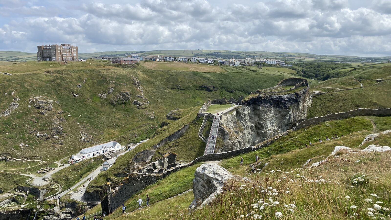
You do not have to pay to enter the castle to do the walk. Some of the best views of the island, the ruins and the bridge are from the coast path itself, and many walkers admire it from the outside and press on north. If you want the full castle visit, allow a couple of extra hours and save it for a separate outing.
The route
From the castle, the coast path climbs north onto the cliffs. Within the first mile you pass above Bossiney Haven, a small sandy cove tucked below the cliffs and reached by a steep side path if you fancy a detour to the beach.
Shortly after comes Rocky Valley, one of the highlights of the walk. A river runs down a slate gorge to the sea here, and a short detour inland brings you to the mysterious labyrinth carvings cut into a rock face near the ruins of an old mill at Trethevy. Their age is debated, which only adds to the atmosphere.
Beyond Rocky Valley the path climbs again and rounds the Willapark headland, a grassy promontory topped by an old white lookout tower, now a National Coastwatch station. From here the cliffs run high and exposed, with long views forward to Boscastle and back towards Tintagel.
The final stretch drops steeply into the deep combe above Boscastle and follows the path down to the harbour. The descent is knee-testing after the miles behind you, but the reward is the village itself: a narrow, twisting harbour mouth between towering headlands, one of the few natural harbours on this hard stretch of coast.
What it is like underfoot
Honest assessment: this is a strenuous coast walk, not a stroll. The path is well waymarked and popular, but:
- The ground is uneven and rocky in places, with plenty of steps and steep gradients in and out of the valleys.
- Sections run close to unfenced cliff edges. Keep children and dogs close and stay on the path.
- It is fully exposed to the Atlantic weather. On a still summer day it is glorious; in wind and rain it is a serious clifftop walk.
What that means in practice: wear proper walking boots or shoes, take layers and waterproofs whatever the forecast, carry water and a snack, and check the tide times if you plan to visit Merlin's Cave or the coves. It is not a route for a buggy or for smooth-soled shoes.
How to get back
This is the one piece of planning to sort before you set off, because Tintagel and Boscastle are a linear walk apart with no frequent direct bus. The options:
- Two cars: leave one at Boscastle and drive round to start at Tintagel (or vice versa). The simplest solution if there are two of you.
- Taxi: book ahead. Rural taxis here are limited and not always available on spec.
- Out and back: walk both ways for a full day of around nine miles. The return leg looks different in the changed light and gives you the dramatic approach to Tintagel at the end.
- Seasonal bus: a local service runs between the two villages on a limited timetable. Check current times before you rely on it, and plan to walk away from your parked car so you ride back to it rather than the other way round.
Finishing at Boscastle
Boscastle rewards the effort. The National Trust looks after the harbour, and the village has cafes, pubs, galleries and the well-known Museum of Witchcraft and Magic. It is also known for the flash flood of August 2004, when a wall of water surged down the valley and swept through the village; no lives were lost, and the rebuilt village and its improved flood defences are part of the story you will read on the information boards by the harbour.
A pot of tea or a pint by the harbour wall, boots off, is the right way to end the walk before the drive home.
How a Tintagel and Boscastle day fits a couples' break at Trewena
The Arthurian coast sits around 90 minutes' drive from a Trewena base near Falmouth on the south coast: the A39 north past Truro and Wadebridge, then on to Tintagel. That puts it firmly in full-day excursion territory. The usual shape:
- Early start. Leave the cottage by 8.30 to reach Tintagel and park before the village fills.
- Sort the return first. Drop a second car at Boscastle, or confirm your bus or taxi, before you walk.
- Walk: the linear route with plenty of stops, aiming to reach Boscastle for a late lunch.
- Boscastle: an hour to potter round the harbour and village.
- Home for dinner back at the cottage on the south coast, legs pleasantly tired.
For couples on a longer break, this north-coast day is the dramatic counterweight to the gentler south-coast walks on your Falmouth doorstep. Pair it with a low-effort recovery day the next morning, and you have the rhythm of a strong Cornwall week: one big wild day, one slow one.
Plan your visit
- Cottages for couples near Falmouth: the audience overview, and how a Trewena stay works as the base
- Cornwall for couples: the slow Falmouth-weekend shape
- A long weekend in Cornwall for couples: how to build a two- or three-day break around days like this
- The best South West Coast Path walks in Cornwall: more of the coast path, closer to home
- Brown Willy and Rough Tor walk: the Bodmin Moor high-ground day, the moorland counterpart to this coast walk
- Mutton Cove seals: another wild north-coast day out, for the seal season
- Polly Joke poppies: the summer floral counterpart on the north coast
For the brand and booking side, see our three cottages on the rural edge of Falmouth, or drop us a message about availability for the kind of walking-shape week you have in mind.
Tags
Stay in touch
Occasional Cornwall updates from Rich at Trewena. Around four times a year, never more.
Planning a trip to Cornwall?
Three one-bedroom cottages on a smallholding on the edge of Falmouth. A genuine Cornish base for couples and singles.