Brown Willy and Rough Tor: The Circular Walk to Cornwall's Highest Point

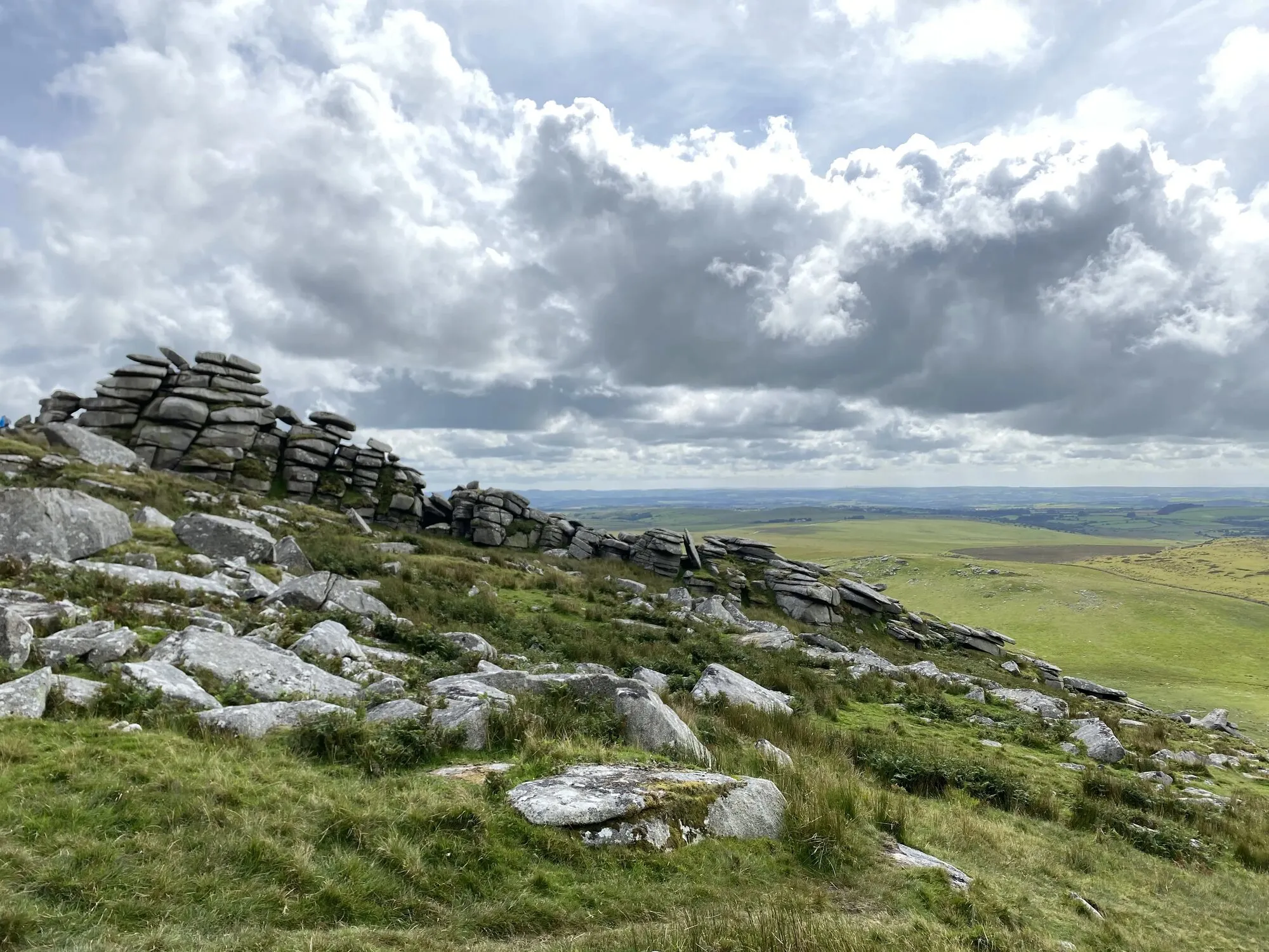
Brown Willy is the highest point in Cornwall. At 420 metres above sea level it is not a mountain by anyone's reckoning, but the walk up to it across the open granite ridges of Bodmin Moor is one of the genuinely big-feeling days you can have in the county. Paired with Rough Tor, its slightly shorter neighbour, it makes the standard high-Cornwall circular: around five miles, three to four hours, with the prize of a two-coasted view at the top.
This is the practical guide: the route, where to park, what it is like underfoot, and how the walk fits a couples' break in Cornwall from a Trewena base on the south coast.
What and where
Brown Willy sits on open Bodmin Moor in north-east Cornwall, around two miles south of the small town of Camelford. It is one of two prominent summits in this corner of the moor:
- Rough Tor (400 m) is the closer of the two to the road. Most walks start here, partly for the parking and partly because the climb is more dramatic and the ridge is busier with granite formations.
- Brown Willy (420 m) sits a mile and a half south-east across the open ground, on the far side of a shallow saddle. The summit is rounded and grassy, with a small rocky cap at the top.
The two are walked together because they are close, because the high open ground between them is some of the most striking on the moor, and because the loop gives you both summits, the granite tors of the Rough Tor ridge, and the long view from Brown Willy on the way back.
The name Brown Willy comes from the Cornish Bronn Wennili, usually translated "Hill of the Swallows". The modern spelling is the kind of thing that ends up on tea-towels.
The walk in brief
- Distance: 5 to 6 miles round trip
- Time: 3 to 4 hours at a relaxed pace
- Ascent: around 200 metres total
- Difficulty: easy to moderate; underfoot conditions matter more than the climbs
- Start point: Rough Tor car park, accessed via Camelford
- Map: OS Explorer 109 (Bodmin Moor)
- Dogs: allowed on lead (cattle and sheep graze the moor)
The route is unmarked but well-trodden. The first half (car park to Rough Tor summit) follows a clear footpath. The middle section across the saddle and up Brown Willy is open access on the line of the boggy drainage. The return follows the outward path back, or loops south through Garrow Tor for a longer day.
Parking and access
Drive to Rough Tor car park on the north slope of the moor. Free, no time limit, no facilities. It is reached via the small lane signposted Roughtor (run-together spelling on the local road signs) from Camelford. Postcode PL32 9QQ. From the south, take the A39 north past Camelford and turn off there.
From a Trewena base on the south coast, the drive is around 90 minutes: A39 north past Truro, A30 across mid-Cornwall, then north on the A39 to Camelford. This is a full-day excursion, not a half-day. Pack a flask.
The route
From the car park, head south up the wide track towards Rough Tor's north face. The path crosses the De Lank River (a stepping-stone affair in summer, ankle-deep in winter), then climbs more steeply onto the lower slopes of the tor. After around 30 to 40 minutes you reach the summit ridge, where the granite stacks of Rough Tor's tor formations rise to either side.
The summit itself is a flat-ish ridge of stacked granite slabs with a long stone wall along the top. Bronze Age burial cairns sit on the higher points; the views open out in every direction.
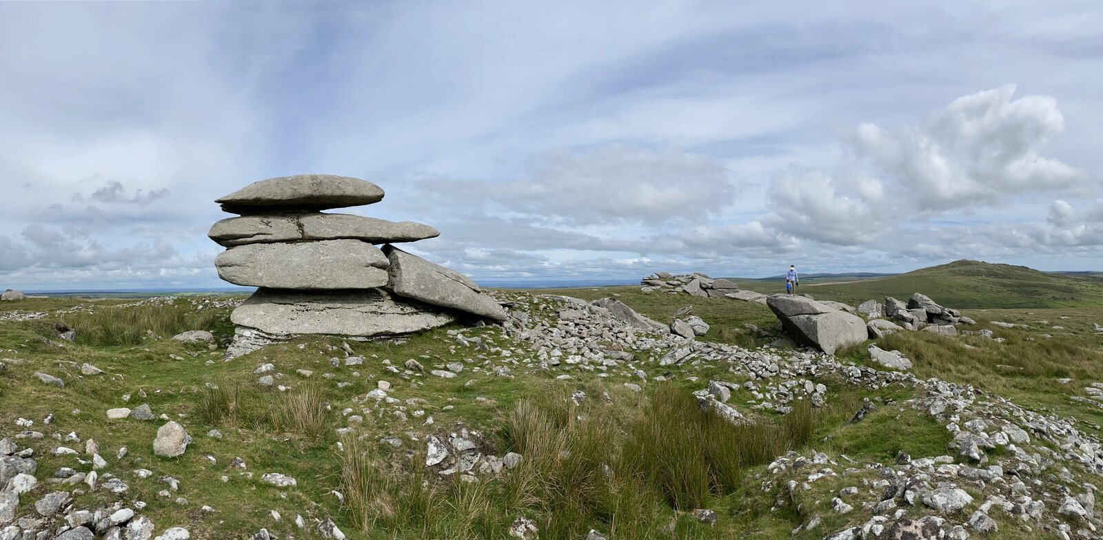
From Rough Tor, drop south-east into the open saddle. The path is less defined here; aim for the obvious rounded summit of Brown Willy a mile and a half away. The ground between is boggy in winter and after rain; in summer it is usually walkable across the line of the drainage. Allow 40 to 50 minutes for this section.
Brown Willy's summit is a small rocky cap on a rounded grass dome. A small cairn marks the top. The view in clear weather is the headline:
- North to the Atlantic coast over Tintagel and Boscastle
- South to the Channel coast over Bodmin and beyond
- East to the distant high ground of Dartmoor (around 30 miles)
- West across the rest of Bodmin Moor and its scattered tors
On a clear day it is the only point in Cornwall where you can see both seas at once.
Return by retracing your steps back to Rough Tor and down to the car park, or loop south past Garrow Tor and back via a longer 7-mile circular if you have the daylight and the legs.
What it is like underfoot
Honest assessment: the moor is wet for most of the year. The path up Rough Tor is firm and well-worn; the saddle across to Brown Willy is boggy after rain and ranges from awkward to genuinely difficult in deep winter. The De Lank River crossing is shin-deep in heavy rain and can be impassable after sustained storms.
What this means in practice:
- Boots, not trainers, year-round. Waterproof if you have them.
- Gaiters in winter and early spring are not overkill.
- Pack a map and a compass. The high ground has few landmarks once you are off the tor ridge, and the mist can come down fast off the Atlantic.
- Tell someone your route if walking alone. Phone signal on the summits is patchy.
This is not a dangerous walk in good weather. In bad weather (low cloud, driving rain, wet ground) it is more serious than the modest height suggests. Pick your day.
When to come
- May to early June: the moor at its greenest, cottongrass coming through, longest daylight, settled weather most likely. The best window.
- September: the heather peaks in full purple bloom across the open ground. A second strong window with the bonus of dramatic light at the edges of the day.
- July and August: good underfoot, but the moor gets midges and the car park is busiest. Earlier or later in the day is calmer.
- October to April: doable for experienced walkers in good conditions. The ground is wetter, the daylight shorter, and the weather more changeable. Storm-day walks here are dramatic but serious.
If you only have one day for it, pick a settled high-pressure day in May or September. The moor on a still clear day is one of the great Cornish walking experiences; the same moor in horizontal rain is a different proposition entirely.
How a Bodmin Moor day fits a couples' break at Trewena
The Bodmin Moor end of Cornwall sits around 90 minutes' drive from a Trewena base on the south coast. That puts it in full-day excursion territory rather than half-day. The standard shape:
- Early start. Leave the cottage by 8.30 to be at the car park before 10.
- Walk: 3 to 4 hours including summit time and a sandwich on Brown Willy.
- Lunch or coffee on the way home. Camelford has a couple of decent cafes; the Jamaica Inn at Bolventor on the moor is the famous (touristy, but warm) option if you want a pint and a fire.
- Home for dinner at the cottage with the wood burner on at Little Avalon if you have it, after a properly earned bath.
For couples on a longer break, Brown Willy is the bigger-feeling counterweight to the gentler south-coast walks on your doorstep. Pair it with a low-day at Argal Lake the next day to give the legs a recovery, and you have the rhythm of a strong Cornwall week.
Plan your visit
- Cottages for couples near Falmouth: the audience overview, how a Trewena stay works as the base
- Cornwall for couples: the slow Falmouth-weekend shape
- Best South West Coast Path walks in Cornwall: for the coast-walk counterpart to a moor day
- Argal Lake walk: the gentle recovery-day walk straight from the cottage door
- Mutton Cove seals: the north-coast wildlife counterpart to Brown Willy's high-ground day
- Polly Joke poppies: the summer floral counterpart on the north coast
- Reasons to visit Cornwall in winter: the season when the moor feels most itself
For the brand and booking side, see our three cottages on the rural edge of Falmouth, or drop us a message about availability for the kind of walking-shape week you have in mind.
Tags
Stay in touch
Occasional Cornwall updates from Rich at Trewena. Around four times a year, never more.
Planning a trip to Cornwall?
Three one-bedroom cottages on a smallholding on the edge of Falmouth. A genuine Cornish base for couples and singles.